
Guiding the Way: Reflections from a Mantle Journey – Planning the Journey
Ki te kāhore he whakakitenga, ka ngaro te iwi.
Without vision, the people will be lost.
Having a plan is crucial.
For me, one of the trickiest parts of planning a Mantle of the Expert unit has always been generating the initial idea. There are so many fascinating topics to explore that choosing just one can feel overwhelming. This challenge was even greater knowing that I had been given free rein by the classroom teacher.
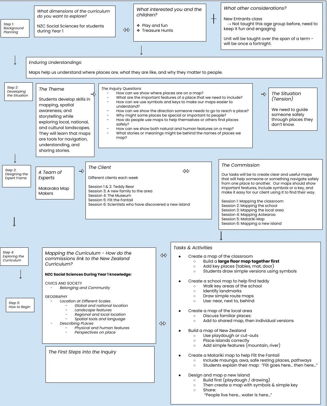
Original planning document
I found myself returning to a few key questions:
What do I want to teach?
What interests me?
What interests five-year-olds?
How could I use the draft Social Sciences curriculum to guide my planning?
My planning document begins with three simple prompts:
What dimensions of the curriculum do you want to explore?
The Year 1 Social Sciences curriculum.
What interests you and the children?
Play, fun, and treasure hunts.
What other considerations are there?
This is a New Entrant class.
I have not taught this age group before.
Learning needs to be highly engaging and accessible.
The unit will be taught once a fortnight across a term.
As I explored the draft Social Sciences curriculum, I found myself repeatedly drawn to the Geography strand. After narrowing down several possibilities, I settled on the enduring understanding:
"Maps help us understand where places are, what they are like, and why they matter to people."
Immediately, ideas began to form.
I wanted students to develop skills in mapping, spatial awareness, and storytelling while exploring places that were familiar and unfamiliar to them. Through their work, they would discover that maps are more than tools for navigation. Maps help us understand our world, share stories, and make sense of the places that are important to us.
The next challenge was designing the expert frame.
Who would we be?
The answer came surprisingly quickly: Makaraka Map Makers.
As expert map makers, our responsibility would be to create clear and useful maps to help someone navigate safely from one place to another. Our maps would need to show important features, include symbols and keys, and communicate information clearly so our clients could find their way.
With the expert frame established, I began thinking about the sequence of learning. Because I would only be teaching the class once every fortnight, each episode needed to feel complete while also contributing to the larger story. I had to think carefully about how concepts could be introduced, revisited, and built upon in ways that would make sense for our youngest learners.
My original plan was straightforward:
Session 1: Mapping the classroom
Session 2: Mapping the school
Session 3: Mapping the local area
Session 4: Mapping Aotearoa New Zealand
Session 5: Matariki Map
Session 6: Mapping a new island
Initially, I imagined each session would involve a different client with a different mapping problem to solve.
Then, just a few days before teaching the first session, a new idea emerged.
Up until this point, I had planned for each session to involve a different client with a different mapping problem to solve. While this seemed logical on paper, I began to wonder whether a constantly changing cast of characters would be confusing for a group of five-year-olds, particularly when I would only be seeing them once a fortnight.
Then I had an idea.
What if the same client stayed with us throughout the entire unit?
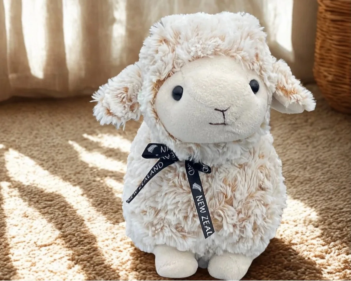
As a release teacher, I was also conscious that I would be walking into a classroom that was new to me. I wanted something that could help build excitement, create continuity between sessions, and provide a reason for the children to immediately invest in our story.
A sheep.
Not just any sheep, but a class mascot who would arrive on my first day and become our client for the entire inquiry. The mapping challenges could change from session to session, but the sheep would remain at the heart of the story.
It was a relatively small adjustment to the planning, but it felt significant. Instead of six separate mapping tasks, I now had the beginnings of an ongoing narrative that could grow alongside the children's understanding of maps and places.
